
Improving Concorde Way: Dovercourt Road consultation 2025
Overview
We want your views on new proposals to make Dovercourt Road, Petherbridge Way and Constable Road safer to walk and cycle along and to reduce through traffic using Dovercourt Road. We also ask if you would like more trees and planting along Dovercourt Road, instead of some of the existing on-street parking.
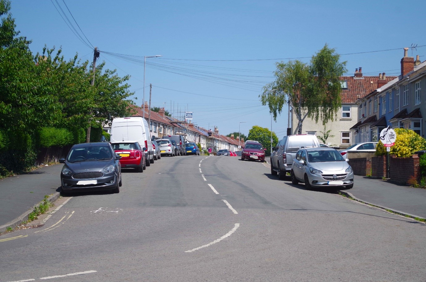 Dovercourt Road looking north from Downend Road
Dovercourt Road, Petherbridge Way and Constable Road are part of Concorde Way, one of Bristol’s key walking and cycling routes. Concorde Way runs from the city centre to Cribbs Causeway through St Pauls, St Werburghs, Ashley Down, Lockleaze and Stoke Gifford.
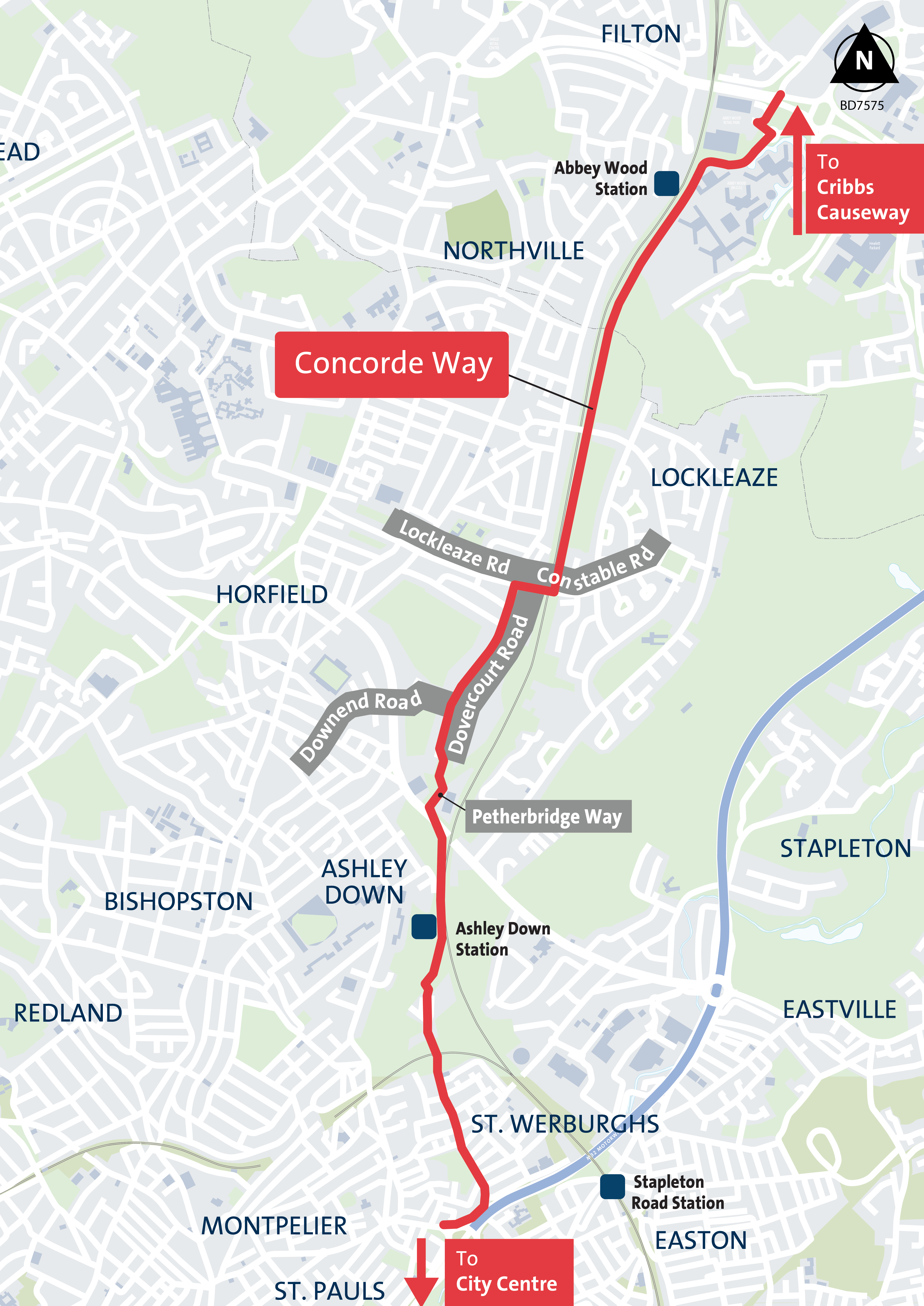 Concorde Way showing Petherbridge Way, Dovercourt Road and Constable Road
Why we are proposing changes to Dovercourt Road, Petherbridge Way and Constable Road
When we asked people about their experience of Concorde Way through earlier engagement in 2022, many people told us that there was too much traffic using the on-road section in Lockleaze and not enough space for pedestrians and cyclists.
We used traffic sensors to count traffic in the area, and this showed us that around 2,000 vehicles travel on Dovercourt Road on most days, which is high for an on-road cycling route.
The data also showed us that, at peak times, between half and three quarters of vehicle traffic using the road is through traffic, not local traffic.
We have investigated the option to create an off-road route alongside the railway. However, land ownership issues and the cost of a new bridge across the railway, makes this unviable.
What we are proposing
We are now proposing changes to make Dovercourt Road, Petherbridge Way and Constable Road safer and more pleasant to walk and cycle along. This aims to improve the whole on-road section of Concorde Way in Lockleaze to ensure a good connection between the off-road section at Ashley Down Station and the Bonnington Walk section.
Proposed changes include:
- A traffic filter on Dovercourt Road (road narrowing and bollards) to prevent through traffic. Pedestrians and cyclists would be able to travel through the traffic filter
- Four raised crossing points at the following locations:
- Dovercourt Road/Constable Road/Lockleaze Road junction
- On Dovercourt Road at the entrance to Muller Road Recreation Ground
- On Dovercourt Road by the path leading to Brook Bridge
- On Petherbridge Way next to Brook Bridge
- Planting and street trees along Dovercourt Road
- A zebra crossing and speed cushions on Constable Road
- Shared-use footways (pavements) and double yellow lines on Constable Road and Petherbridge Way
Further improvements are planned on Dovercourt Road as part of the Goram Homes development of the former Dovercourt Depot. These will include two more crossing points and improvements to tactile paving on Dovercourt Road and Downend Road.
The aim of Goram Homes’ changes is to slow down vehicles and make it easier for Disabled people and pedestrians to cross Dovercourt Road and the junctions with Elmore Road and Chedworth Road.
We are not asking for your views on Goram Homes’ works in this survey as they have been agreed as part of the planning application process.
Closed for feedback
Ended: 1 September 2025
What happens next
We will analyse all the responses to this consultation. Your feedback will help us to develop our proposals for this section of Concorde Way.
If there is support in principle for more trees, we will prepare designs for where they could be planted. This will depend on the location of underground services (such as gas, electricity, water, telecommunications), traffic and access requirements, and the feedback to this consultation. We would then ask for your views on the specific locations.
The responses to this consultation and any further consultations on specific proposals for trees will be considered when making a final decision.
If we take forward plans for the proposed traffic filter (location with road narrowing and bollards in the road), double yellow lines, speed cushions and raised crossing points, we would hold a Traffic Regulation Order statutory consultation before a final decision is made by the Executive Director Growth and Regeneration on behalf of the council’s Transport and Connectivity Committee.
If the decision is made to build the scheme, we anticipate the project would be completed by the end of 2027.
Key dates
- Start date: 7 July 2025
- End date: 1 September 2025