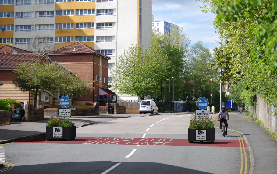
A bus gate west of the Marsh Lane junction and east of Beam Street.
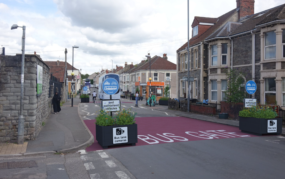
It will include red road surfacing, 'bus gate' road markings and is enforced with cameras. There will not be any bollards, which means emergency services would not have to remove a bollard during an emergency.
The zebra crossing will stay in the middle of the bus gate. The bus gate will help the number 5 bus service by stopping traffic travelling along Avonvale Road and Beaufort Road.
Go to our bus gate exemptions page to find out:
- what vehicles are exempt from bus gates
- about support for low income households
- how to apply for an exemption if:
- you have a Blue Badge
- your vehicle has a disabled tax class
- you're a professional carer working in residents' homes
A bus gate at the junction of Avonvale Road with Pilemarsh.
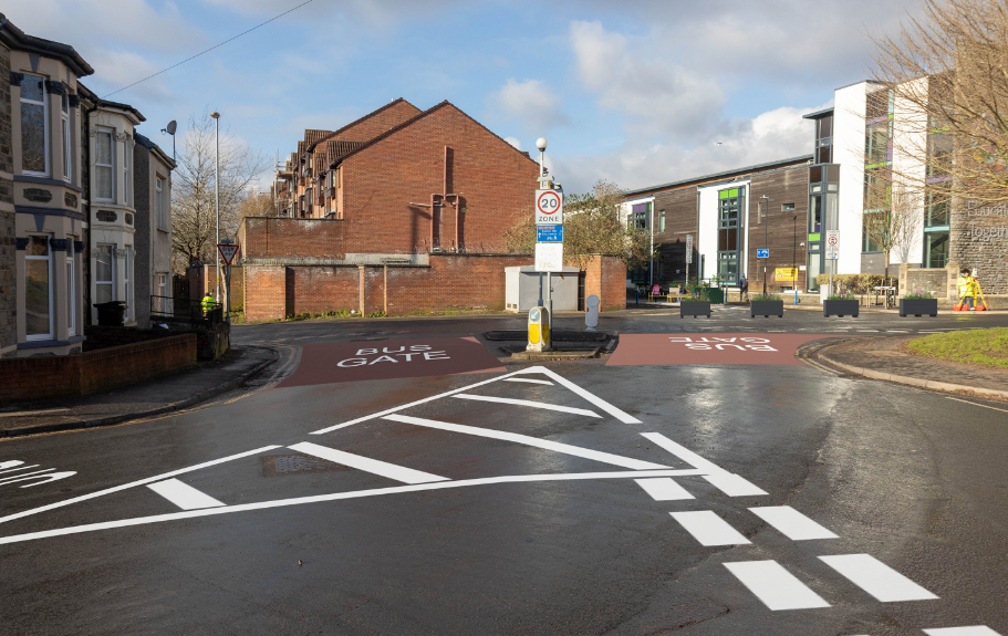
It will include red road surfacing, 'bus gate' road markings and is enforced with cameras. There will not be any bollards, which means emergency services would not have to remove a bollard during an emergency.
The bus gate will help the number 5 bus service by stopping traffic travelling from Church Road (A420) through Avonvale Road onto Blackswarth Road.
Go to our bus gate exemptions page to find out:
- what vehicles are exempt from bus gates
- about support for low income households
- how to apply for an exemption if:
- you have a Blue Badge
- your vehicle has a disabled tax class
- you're a professional carer working in residents' homes
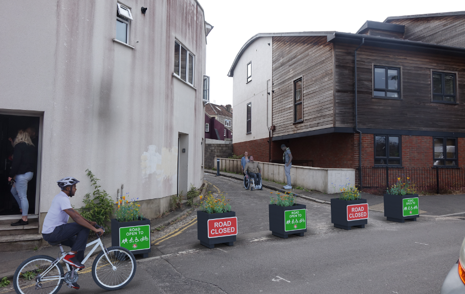
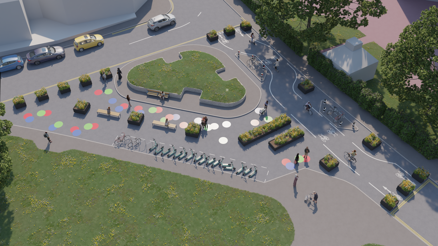
A pocket park on Barnes Street.
It will help stop traffic skipping the traffic signals at the Blackswarth Road to get to Church Road (A420).
People can still get to the area by car using alternative routes, but will not be able to pass through this point.
A loading bay will be introduced on Barnes Street to allow businesses to unload.
The measure also provides space for improvements, such as seating, tree planting and cycle parking.
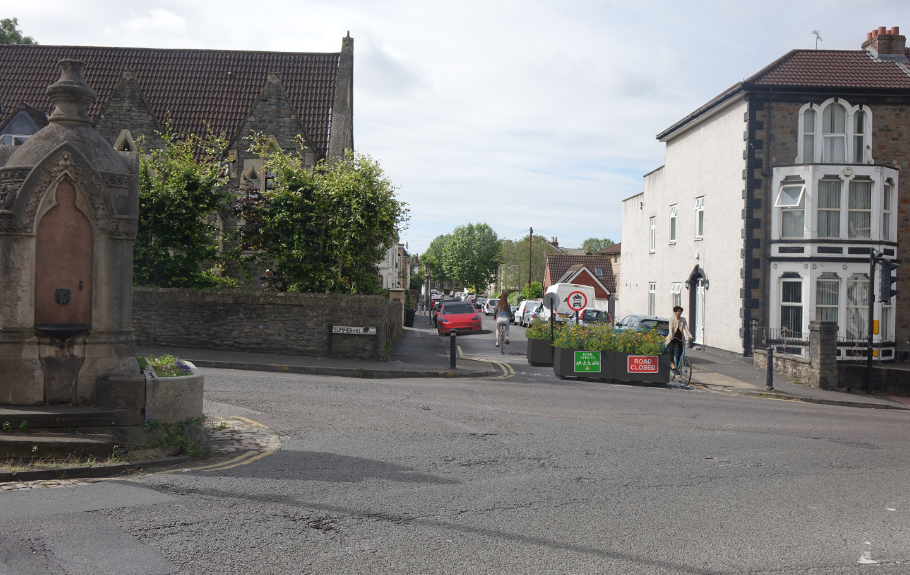
A modal filter on Beaufort Road, west of the junction with Northcote Road.
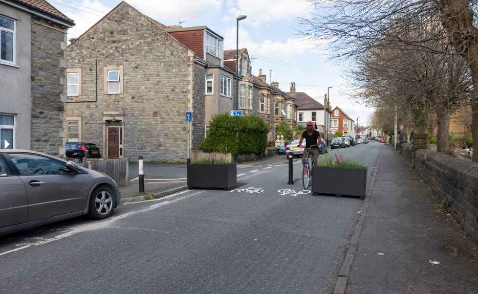
It will help stop traffic on Beaufort Road getting to Church Road (A420) and Summerhill Road (A431).
People can still get to the area by car using alternative routes, but will not be able to pass through this point.
Cyclists will be able to travel through the middle of the filter.
A pocket park at the junction of Beaufort Road and Blackswarth Road.
It will help stop traffic using Beaufort Road to get to Church Road (A420).
It will improve walking and cycling routes to schools by reducing traffic on the Welsey Way, which runs along Beaufort Road.
People can still get to Beaufort Road by car using alternative routes, but will not be able to pass through this point.
Cyclists will be able to travel through the middle of the pocket pack and the pedestrian crossing will still be there.
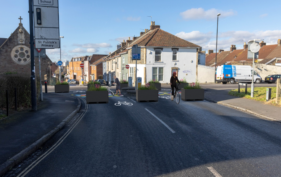
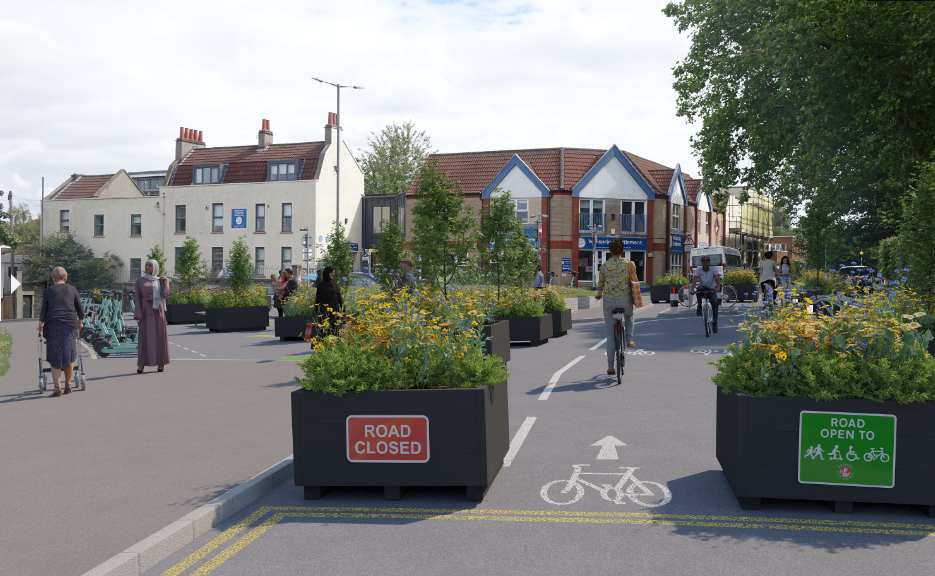
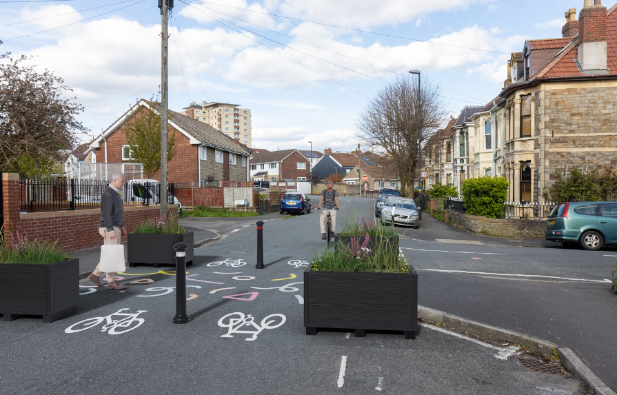
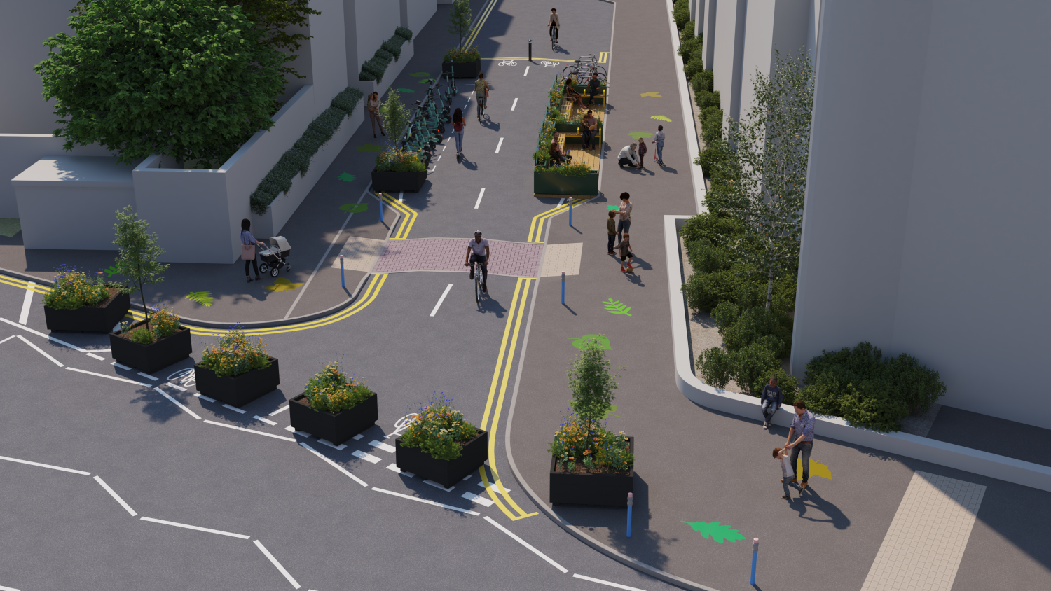
A pocket park on Cobden Street at the junction of Morley Street and Victoria Avenue.
It will help stop traffic coming from Avonvale Road and Marsh Lane.
People can still get to the area by car using alternative routes, but will not be able to pass through this point.
Cyclists will be able to travel through the middle of the filter.
The measure also provides space for improvements, such as seating, tree planting and cycle parking.
The pocket park will link walking and cycling routes towards City Academy, Church Road and the Bristol to Bath Railway Path.
Longer-term improvements are planned for the Crews Hole area.
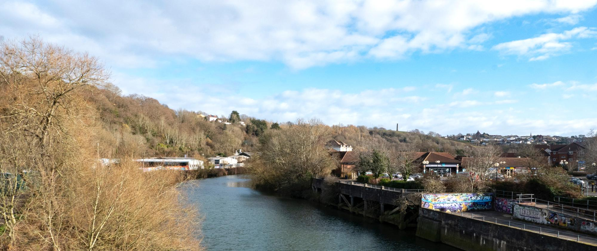
These include:
- formal crossings at Netham Lock and Conham Road
- lighting improvements alongside the River Avon path
- informal crossings at pinch points
For the trial scheme, we will install temporary crossing and traffic calming improvements in the following locations:
- next to Strawberry Lane footpath
- next to Mama Bear's Day Nursery
- next to the Crews Hole and Troopers Hill Road junction
A pocket park on Barton Hill Road and Ducie Road.
It will stop traffic travelling from Days Road towards Church Road.
Planters will also be installed on Ducie Road to stop traffic entering the area around the grass island.
Cyclists will be able to travel through the pocket park.
People can still get to the area by car using alternative routes, but will not be able to pass through this point.
The measure also provides space for improvements, such as seating, tree planting and cycle parking.
A parklet, including seating and cycle parking will be installed during the trial for people visiting the Wellspring Settlement.
A modal filter on the approach to the bridge over the railway.
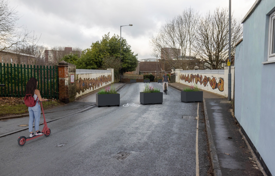
It will stop traffic from Church Road (A420).
People can still get to the area by car using alternative routes, but will not be able to pass through this point.
Cyclists will be able to travel through the middle of the filter and a cycle lane would be marked for people cycling towards Lawrence Hill station and the city centre.
Parking restrictions near the bridge are being reviewed so that more parking places could be reinstated.
A modal filter on Glebe Road.
It will stop traffic from Church Road (A420) going through Beaufort Road.
People can still get to the area by car using alternative routes, but will not be able to pass through this point.
Cyclists will be able to travel through the middle of the filter
Make Grindell Road two-way
This will give vehicles an alternative when entering and leaving the area, rather than the steep approach from Pilemarsh onto Blackswarth Road. This change will be monitored alongside the rest of the scheme.
A modal filter on Kingsmarsh Way.
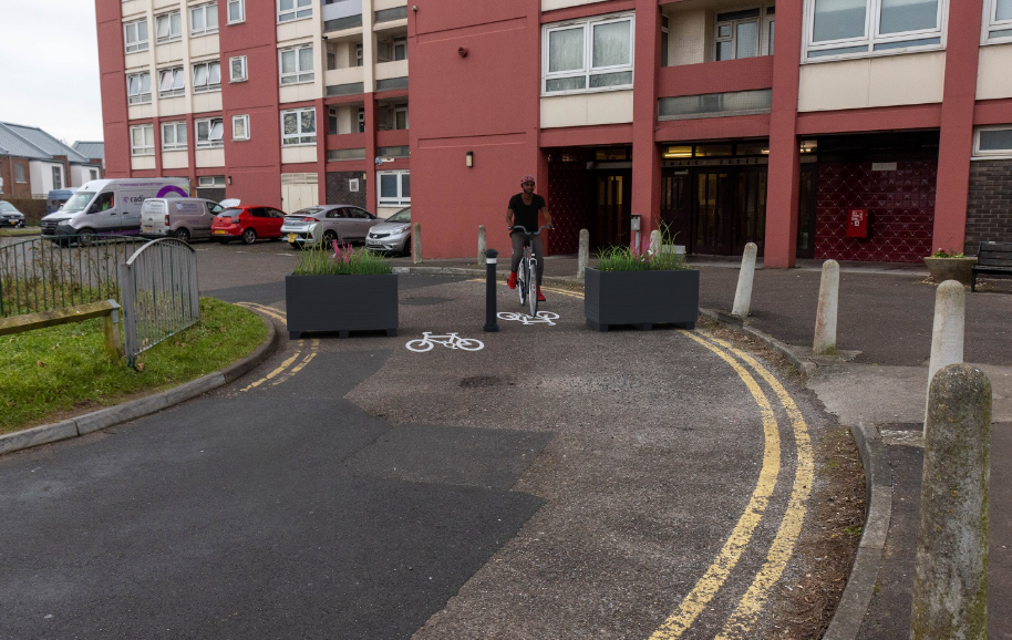
It will help to stop traffic between Croydon Street (A420) and St Philips Causeway (A4320).
It will still be possible to get to the car park at Kingsmarsh House.
People can still get to the area by car using alternative routes, but will not be able to pass through this point.
Cyclists will be able to travel through the middle of the filter
A modal filter opposite Lincoln Gardens next to the turning area.
It will help to stop traffic between Church Road (A420) and St Philips Causeway (A4320).
People can still get to the area by car using alternative routes, but will not be able to pass through this point.
Cyclists will be able to travel through the middle of the filter
The measure also provides space for improvements, such as seating, tree planting and cycle parking.
A bus gate on Marsh Lane between Glendare Street and Barton Court.
It will include red road surfacing, 'bus gate' road markings and is enforced with cameras. There will not be any bollards, which means emergency services would not have to remove a bollard during an emergency.
The bus gate futureproofs the scheme for a potential bus route connecting Barton Hill and Redfield to Temple Meads, the new university campus, and the city centre via Avonvale Road and Feeder Road.
Go to our bus gate exemptions page to find out:
- what vehicles are exempt from bus gates
- about support for low income households
- how to apply for an exemption if:
- you have a Blue Badge
- your vehicle has a disabled tax class
- you're a professional carer working in residents' homes
Make Morton Street one-way
Vehicles will travel north on Morton Street. This will allow locals to get to Church Road, while stopping traffic from Church Road (A420) going south.
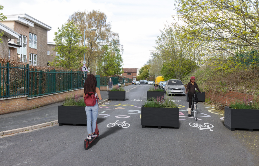
A modal filter on The Avenue, west of Jubille Road.
It will stop traffic travelling along Beaufort Road through to Church Road (A420) and Summerhill Road (A431), and make it easier and safer for people walking towards Troopers Hill.
People can still get to the area by car using alternative routes, but will not be able to pass through this point.
Cyclists will be able to travel through the middle of the filter
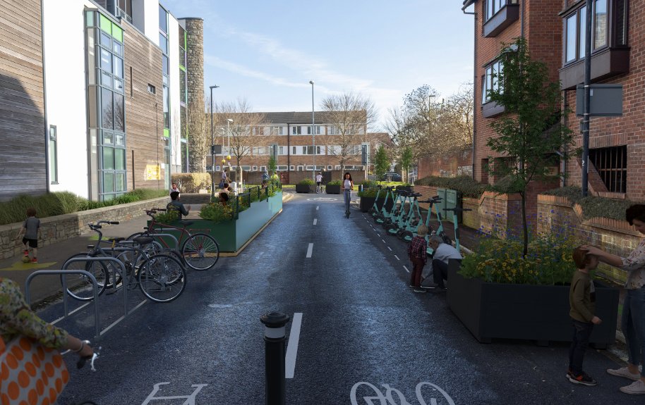
A pocket park outside Redfield Educate, at the junction of Victoria Avenue and Avonvale Road.
It will help stop traffic travelling between Avonvale Road and Church Road (A420).
This will make it easier for parents and children walking, scooting, wheeling and cycling to school.
The measure also provides space for improvements, such as seating, tree planting and cycle parking.
A parklet will be installed during the trial for people visiting the school.
Draper Court residents will be able to access the shared car parking via Leonard Road and Victoria Avenue.
Cyclists will be able to travel through the pocket park.
People can still get to the area by car using alternative routes, but will not be able to pass through this point.
A modal filter on Victoria Avenue, east of the junction of Baden Road.
It will help stop traffic between Avonvale Road and Church Road (A420), as well as improve walking and cycling on the Wesley Way route, which runs along Victoria Avenue.
People can still get to the area by car using alternative routes, but will not be able to pass through this point.
Cyclists will be able to travel through the middle of the filter
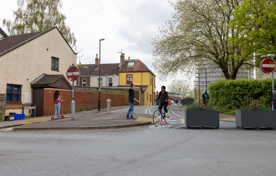
A modal filter on Wicket Lane.
It will stop vehicles using Wicket Lane to avoid the Chalks Road and Church Road junction.
Cyclists will be able to travel through the middle of the filter.
We originally proposed putting a pocket park at the junction of Cossham Road and Church Road (A420). However, there were concerns about how larger vehicles would leave the area, as they would need to use alternative streets that are less suitable, such as Seneca Street and Sherborne Street. So we decided on a modal filter on Wicket Lane instead.