The planning process aims to find a balance between:
- buildings
- landscape
- movement
Transport Development Management (TDM) input into this process.
Use this guidance alongside the Supplementary planning documents, practice notes and other planning guidance for developments.
This design guidance is a tool to help developers:
- meet the transport related elements of these policies
- create high quality street design
Developments should meet the council's Local plan policies.
Read pdf a summary of the planning policies(288 KB) TDM use.
This Transport Development Management Guide (TDMG) is not a Design Code. However, it will likely influence future planning design guidance when it comes forward.
We expect a future citywide planning design approach to show:
- how this street Design Guidance should be applied in different parts of the city
- how other planning considerations can be balanced with this street Design Guidance
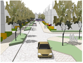
Streets do more than give us a way to move around, as the Manual for Streets shows.
Any new streets we build need to be:
- a safe and easy way for everyone to move around, regardless of their age or physical ability
- healthy places, where people want to live, socialise, and explore
- an efficient use of land, allowing space for nature and trees to exist in public places
- distinctive, attractive and interesting
- easy and cost effective to maintain
Creative design can make sure new streets:
- allow reasonable levels of development, for example more housing
- carry out their legal functions, for example carrying traffic and allowing people to move around freely
To improve biodiversity and the environment, planning developments need to include:
- sustainable drainage
- trees and other planting, for example flowerbeds or grassed areas
If you use our guidance from the start of the process, you can include planting and sustainable drainage within street layouts. This uses the land more efficiently.
To help developers design new streets, we've created:
- the pdf Street Design Matrix(671 KB) , which sets out our design standards and expectations
- some pdf examples of good practice(42.17 MB) on how you might apply the Guidance in a suburban development
- design factsheets with more detailed advice
Designing to these standards will:
- make sure streets work for everyone who uses them, regardless of age, physical ability, or mode of transport
- give opportunities to include:
- planting
- parking
- street furniture
- parking
This will make streets enjoyable for everyone.
We'll look at each site and its specific circumstances and review it against our policies and guidance. We'd apply the street Design Guidance to the characteristics and constraints of the specific development site.
These guidelines set out our expected standards in line with local and national guidance. TDM will work with developers where departures from the standards can be justified, on a site by site basis.
Off street parking spaces and private drives guidelines
For street layout guidance, we've created:
- the pdf Street Design Matrix(671 KB) which sets out our design standards and expectations
- some pdf examples of good practice(42.17 MB) on how you might apply the Guidance in a suburban development
- design factsheets with more detailed advice
Our pdf off street parking and private drives guidance(210 KB) has detailed design requirements and guidelines for:
- private accesses
- driveways
- off-street parking spaces
Private accesses may serve up to five houses.
Street types and adoption criteria
Streets can be:
- private accesses, serving up to five houses
- shared surface streets, suitable for very low speed and traffic levels
- grade separated streets, suitable for all types of street
Streets that serve more than 5 houses, or, in the case of flats, are likely to have a lot of traffic, should meet our design standards. We'd consider adopting these streets for ongoing maintenance.
We will not adopt a street:
- with five or fewer houses
- that does not meet our design standards
The principles of grade separated streets and shared surfaces
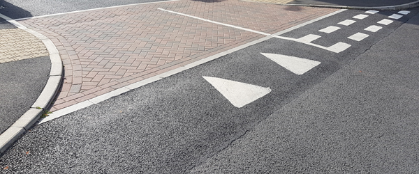
Grade separated streets have separate kerbed footways (pavements).
Shared surfaces have no distinction between footway and carriageway (pavement and road).
There are benefits to both categories.
The principles of shared surface streets and grade separated streets are covered in:
- Manual for Streets (DfT 2007)
- Manual for Streets 2
Since the publication of Manual for Streets and Manual for Streets 2, research and legislation show that, to be safe, streets must:
- be accessible, inclusive, and easy to navigate
- build in healthy transport options
- meet the needs of an ageing population
We believe that:
- in very light traffic streets, a shared surface design can be suitable
- in heavy traffic streets, a more traditional grade separated street design would be better
Find out more in the pdf Street Design Matrix(671 KB) .
Industrial roads guidance
Industrial roads are not classified as streets.
Find more industrial roads design information in our pdf Industrial Roads guidance(96 KB) .
Street types
Every street will be part of a network of different types of streets. Streets are arranged in a hierarchy based on:
- design
- function
- number of users
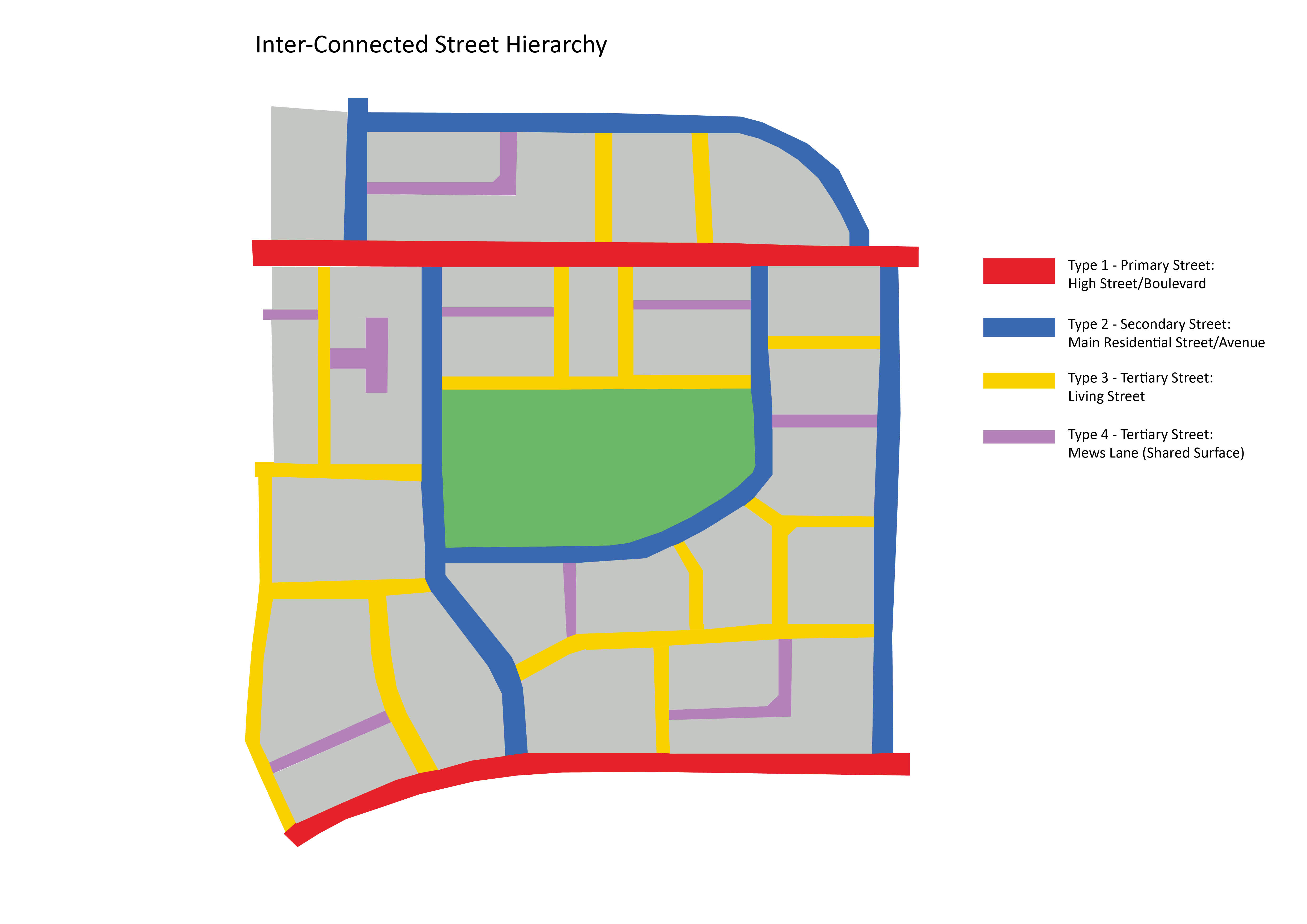
Early masterplanning of a development allows designers to work out how the street network might look.
How to use the Street Design Matrix
Streets are split into four types:
- type 1: primary streets: busy streets with a mixed use function, such as a high street
- type 2: secondary streets: mainly residential but have higher traffic, giving access to quieter residential streets
- type 3: tertiary streets: grade separated, quieter residential streets with less traffic
- type 4: tertiary streets: shared surface, quiet residential streets with very low traffic
The pdf Street Design Matrix(671 KB) shows the design standards and expectations for each type of street. It:
- sets out the essential adopted highway corridor requirements
- lists additional corridor requirements, such as buffer strips, street furniture
- specifies the minimum dimensions and further details for each of these requirements
The red bold text shows the standards we'll insist on.
Read the pdf Street Design Matrix(671 KB) alongside the accompanying factsheets in the Design Standards section.
The folder example streetscape layouts:
- give more context to the matrix
- show a variety of examples of good practice
The minimum dimensions will support sustainable development by allowing for short sections of narrowing in streets.
These narrowings can include green infrastructure or other street furniture and features, without impacting the safety or function of the street.
We will not support proposals designed to the minimum dimensions, without considering:
- green infrastructure
- improvements to the public realm
Designs that deviate from the standards set out in the matrix will be subject to a departures process. This is likely to add costs to the scheme for the developer.
To find out more about the departures process, email the Transport DM Team.
Over the years the needs of motorised traffic has in some instances taken priority over other more sustainable modes of transport.
This has resulted in worsening safety and environmental conditions for pedestrians, cyclists, public transport users and local residents.
When designing for any highway scheme, you must consider:
- safety
- all highway users
- sustainability and durability
- quality
Junction capacity
Capacity assessment modelling will be required to assess the effect of additional traffic generated by the development where it impacts on a junction or the wider highway network. Find out more in pdf section 2.1.4 of the TDMG(2.19 MB) .
We can provide advice on the appropriate modelling tool, though we have limited pedestrian data available. This means more counts may therefore be required to allow for pedestrians to be incorporated into junction modelling.
Information about traffic count data can be found on Traffic monitoring page or by emailing transport.data@bristol.gov.uk
Where there's a risk of conflict or capacity issues, it may be necessary to install traffic signals. These will be secured through a highway agreement and commuted sums will apply for any new or altered traffic signals.
Contact our Traffic Signals Team at traffic@bristol.gov.uk for all traffic signal design.
Junction spacing
Junctions are key points along the highway network where most conflicts and collisions take place involving all road users.
Good junction design should therefore provide sufficient capacity and convenience as well as safeguarding all road users.
See our pdf Junction Spacing and Treatment guide(186 KB) .
Visibility
Unimpeded visibility is necessary to ensure that all road users have a clear view of approaching traffic. If visibility is obscured, this can result in unsafe manoeuvres leading to conflict and potential collisions.
All requirements and guidelines are provided within our pdf Visibility guidance(227 KB) .
Specific design requirements for larger vehicles
Due to their size, special consideration must be given to larger vehicles to make sure that they can appropriately manoeuvre on and off the highway.
All requirements and guidelines are provided within our pdf Deliveries and Servicing guidance(118 KB) .
Emergency access
Developers must consult with the police, fire and ambulance services during the design and planning stages, particularly if their design limits access for emergency vehicles to any part of the development.
All requirements and guidelines are provided within our pdf Emergency Access guidance(91 KB) .
Turning and swept paths
Designers will need to ensure that vehicles can enter and exit new developments without overrunning non-carriageway areas. Overrunning can create damage and trip hazards, and intimidate vulnerable road users. Designers must consider:
- swept paths
- designing for the vehicles that are required to access the development
- junction radii
- turning heads
All requirements and guidelines are provided within our pdf Turning and Swept Paths guidance(142 KB) .
The design vehicles for each type of street are outlined in the pdf Street Design Matrix(671 KB) .
Traffic calming
Traffic calming measures reduce traffic speeds and improve safety.
It is better to design speed reducing features into the design of new streets rather than retro-fitting.
More considerations for traffic calming for new developments are provided within our pdf Traffic Calming guidance(129 KB) .
Gradients
Excessive gradients can prevent people being able to access developments, and can cause safety and drainage problems. Guidance on gradients in new streets is provided within our pdf Gradients guidance(139 KB) .
Designing for walking
Nearly all of us walk as part of each of our journeys. We want to make it easier to do this, as it supports health and reduces dependence on driving.
New developments must be safe and easy to use for all pedestrians, including those with mobility impairments as required by the Equality Act 2010 Go to https://www.equalityhumanrights.com/en/equality-act-2010/what-equality-act (opens new window).
For the purposes of this guidance, walking includes wheeling in a wheelchair, or mobility scooter.
We want our new streets to be safe and pleasant to walk or wheel for everyone using them. For example, we want new streets to:
- be safe and easy to understand for a child
- be easy to navigate for a person with dementia
- provide calm spaces for people with neurodiversity
- feel well-lit and overlooked to make sure women feel safe
We want to join up walking networks, and make sure there's permeability in development sites. Walking should be the most direct and convenient way of getting around.
Our Local Plan policies support the delivery of improvements to transport infrastructure, including a network that encourages walking and cycling. We expect developments to offer:
- accessible and pleasant walking environments within the site
- good connections to the surrounding walking and public transport network
Active travel is important to our physical and mental health. We will not support developments that inhibit, obstruct or otherwise preclude the delivery of safe, segregated and permeable walking and cycling routes.
Key design principles and details are provided within our pdf Designing for Walking guidance(877 KB) .
Crossing facilities
Where a development results in a requirement to cross a road, such as at a junction, crossing facilities will be required.
All pedestrian crossing points should be designed appropriately and consider all users, including children, older people and users with with mobility or visual impairments.
All details and requirements are provided within our pdf Crossing facilities guidance(205 KB) .
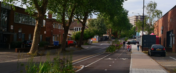
Designing for cycling
The investment we've made in cycling in recent years has:
- further cemented Bristol's status as the country's first Cycling City
- led to a significant increase in cycling
We should build and improve on this, in order to:
- reduce our reliance on fossil fuels
- meet our climate change goals
This is being reflected nationally where the level of priority and funding given to cycling continues to increase.
All developments should maximise the opportunities to support cycling through:
- safe and connected routes
- abundant and high quality cycle parking provision
- on site facilities such as showers, changing rooms and lockers for equipment, clothing and cycle maintenance
We're committed to:
- removing gaps in the existing cycle network
- actively pursuing additional links to serve new developments
The layout and design of a cycle route should aim to provide safe, direct, secure and visually attractive infrastructure. It should:
- avoid the sharing of space with pedestrians or heavily trafficked carriageways
- eliminate the need for cyclists to dismount
Cycling infrastructure should accord with Local Transport Note 1/20 - Cycle Infrastructure Design. It should take into consideration factors such as:
- location
- traffic volumes and vehicle speeds
- topography and scale of development
Our pdf Designing for Cycling guidance(1017 KB) has details on:
- key principles of cycle route design
- types of cycle routes
- cyclists at junctions
We expect all developers to become familiar with and incorporate into new development the requirements of our pdf Cycle Parking guidance(499 KB) and pdf Cycle Parking: supporting facilities guidance(70 KB) .
Public Rights of Way (PROW)
Public Rights Of Way are highways established in law, and are fully protected from being obstructed or diverted without proper authority.
The potential implications that any development may have for the existing PROW network need to be fully considered by the designer at pre-application stage.
All details are provided within our pdf PROW guidance document(156 KB) .
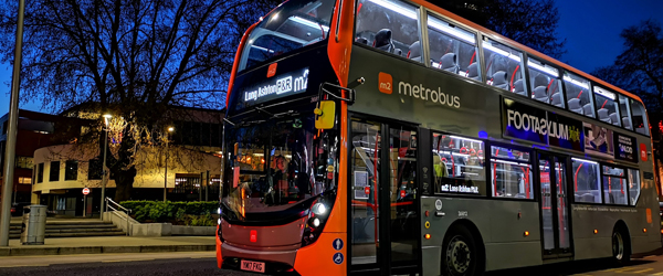
Over 40 million public transport trips are made in Bristol each year.
Improving access to public transport is critical to:
- connecting communities with services and reducing social exclusion
- providing the public with healthy and sustainable travel choices
- deterring the use of private car
- encouraging physical activity
- minimising congestion and improving air quality
We expect developments to provide suitable access to the public transport network and for developers to contribute towards improvements to public transport infrastructure, especially if the development relies on sustainable transport and low car provision.
These improvements could include making better links to stops, upgrading local bus stops, or providing bus routes or links.
Some larger developments may be expected to provide bus links or public transport hubs.
We consider developments to be within reasonable access to public transport facilities if they are:
- within a safe and easy 300m walk of a bus service which operates between the site and major areas of employment
- with a service frequency of at least every 20 minutes all day Monday to Saturday and a service on Sundays
We will not support developments that either inhibit, obstruct or otherwise preclude the delivery of our wider public transport strategies and goals, which are to enhance the coverage or frequency of services, improve the passenger experience and reduce public transport journey times.
Bus routes and bus stops
For major developments and masterplans and where clusters of high density development generate significant travel demand, we insist that these proposals are served by direct and uncongested routes for public transport. They will need to minimise bus journey times in preference to convenient access for general traffic. In some developments we will require enforceable bus lanes or bus only links.
The type and layout of bus stops and shelters will depend on the location of the stop along the route, the service using the route and passenger demands.
Our pdf Designing for buses(164 KB) guidance provides details of what we recommend and design principles for bus routes and bus stops.
When you're considering making any changes to bus routes or bus stops, you'll need to consider our pdf guidance on making changes to bus routes and bus stops(117 KB) which outlines some of the processes you need to be aware of.
Taxis
Facilities to allow drop off and pick up are required where a development is likely to generate a significant amount of taxi activity.
A designated taxi stand or set down drop off facility may be required. This will inevitably result in changes to waiting restrictions and consultation with taxi providers, so can take some time to design and install.
Early discussion with us is strongly advised.
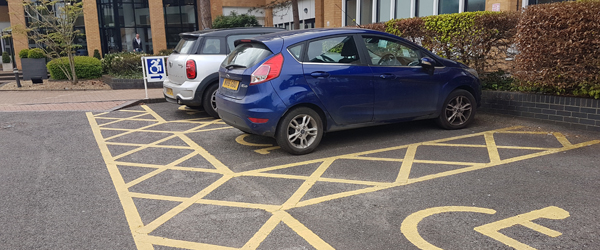
Car, cycle and disabled parking requirements are set out in the Local plan and represent:
- the maximum number of spaces appropriate to the development in relation to car parking
- the minimum number of spaces appropriate in respect of disabled parking, electric vehicle parking and cycle provision
Parking surveys may be required if there's a shortfall of parking identified within the planning application that could have an on-street impact. For our guidance on how to conduct a parking survey, see our pdf Parking Survey Methodology(79 KB) .
Cycle parking
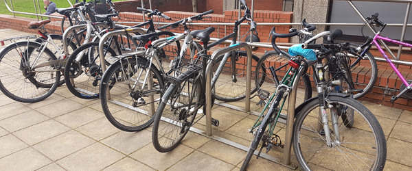
To encourage cycle use, it is important that you provide appropriate levels of cycle parking. It's unacceptable to provide uncovered or unsecure long-term cycle parking as this will not meet standards and will do very little to encourage active travel or achieve sustainable development. For detailed design guidance for cycle parking, see our pdf Cycle Parking guidance(499 KB) .
To make sure that cycling is an attractive option for commuting in all weathers and to encourage longer distance cycling trips, developments which contain businesses are expected to provide pdf supporting facilities(70 KB) such as:
- showers
- changing and drying facilities
- lockers
Car parking
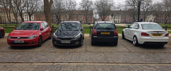
Developments should design adequate space to reduce the impact of on-street parking on local streets.
General principles for car parking design for developments can be found in our pdf car parking design guidance(884 KB) .
For design guidance specifically for private parking spaces for residential developments, see our pdf off-street parking and private drives guidance(210 KB) .
Electrical vehicle (EV) charging
There are various things to consider with regard to EV charging, such as charging speeds, charging networks, the location and design of parking spaces and charge points, and the capacity of the electrical network to accommodate the level of charging required. All of these issues will need to be considered early on in the preapplication / application process. Our guidance for EV charging is currently in preparation, so please contact us if you need further advice.
The Local Plan (Policy DM23) sets out the number of charge points needed under current planning policy. However, you should also be aware of the requirements to provide EV chargers and / or cable routes for parking spaces associated with developments under Part S building regulations.
You can visit the Travelwest EV charging webpage Go to https://travelwest.info/electric-vehicles/charging-points (opens new window) for more information on charging networks.
Motorcycle parking
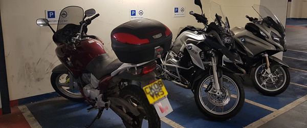
All developments should have motorcycle parking as outlined in our pdf motorcycle parking guidance(111 KB) .
Coach parking
Any proposal which includes coach parking will need to demonstrate that coaches can be adequately accommodated by providing vehicle tracking drawings. A 15 metre luxury coach should be used.
Development which generates coach travel, such as education, leisure, entertainment and hotel uses, will require bespoke coach drop off facilities.
Where significant coach parking demand is anticipated, parking provision for coaches will need to be met on-site.
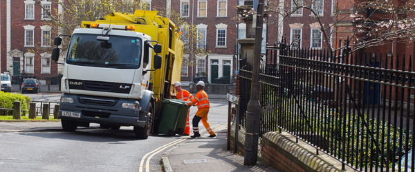
Waste management
Household waste is collected by Bristol Waste Go to https://www.bristolwastecompany.co.uk/ (opens new window).
Their pdf guidance(4.33 MB) sets out the minimum standards you must meet when designing waste facilities for the storage and collection of refuse and recycling in domestic or commercial properties.
Our pdf Waste Management document(149 KB) summarises key design elements of this guidance which are relevant to good street design, particularly in relation to access to wast stores for:
- refuse vehicles
- refuse collectors
- residents and businesses
Underground utilities
The layout of all new development sites will be required to accommodate their own services. It is essential that you contact the relevant statutory undertakers for the installation or diversion of services as necessitated in new development.
You'll need to consider:
- routing of services
- service corridors
- existing underground services
- inspection chambers
- fire hydrants
- district heating
- electric vehicle charging
See our pdf Underground Utilities guidance(106 KB) for more details.
Drainage
A sustainable approach to drainage is essential to:
- lessen the impact of new development on flood risk
- build our resilience to flooding
- better manage water
- remove pollutants at source
Read our guidance on Flood risk and drainage for developers.
Our pdf drainage design guidance(140 KB) outlines key considerations when designing highway drainage. It also gives design details on:
- conventional drainage design
- public foul or surface water sewers
This is for circumstances when sustainable drainage systems are not suitable to use in the highway.
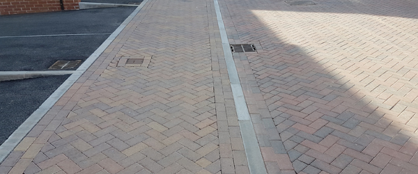
We have a standard palette of materials for highway construction to make sure that the highway can be maintained:
- adequately
- cost effectively
- safely
The type of material used on the highway should be considered at planning stage.
View the pdf Adoptable Highway Material Palette guidance(197 KB) which includes design considerations and specific materials.
See our Highway Features section for guidance on street furniture, such as bollards, lighting, planting etc.
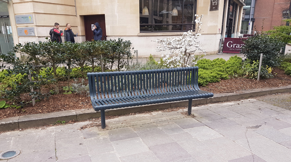
If they are not carefully designed, highway features, such as street furniture and above ground utilities, can be both visually and physically intrusive and reduce the quality of the environment.
Within any design proposals we'll want to see a reduction in street clutter so we can:
- achieve a safer and more attractive environment
- reduce hazards for visually impaired people
The following documents set out design requirements and principles for:

The negative impacts generated by new schools including increased traffic, congestion, anti-social parking and highway safety concerns, must be minimised. Pre-application discussions are essential to allow sufficient consideration to be given to this form of development.
School developments which create significant additional traffic will be expected to deliver works to improve the local highway network and encourage travel by sustainable modes of transport, such as cycling and walking.
Our pdf School Development guidance(143 KB) details what we expect in terms of:
- transport statement and assessment requirements
- school travel planning
- likely infrastructure requirements
We use Modeshift STARS to set up and monitor school travel plans. If you need help setting up your school on Modeshift STARS, contact activetravel.schools@bristol.gov.uk.
Green infrastructure is important because: it:
- looks attractive
- stores carbon
- provides habitat for wildlife
- reduces the impact of noise and air pollution
- helps to reduce flood risk
Street trees also provide shelter, summer shade and cooling.
The National Planning Policy Framework requires new development to contribute positively towards the natural and local environment. In terms of street design, the inclusion of planting and trees will play a significant role in achieving this aim. Street trees and planting:
- add to the character, quality and identity of places
- support nature and ecological enhancement
Read pdf guidance on how to incorporate green infrastructure into street design(838 KB) .
During the planning process, you'll need to get further specialist advice on:
- appropriate types of planting
- suitable arrangements for management and maintenance
p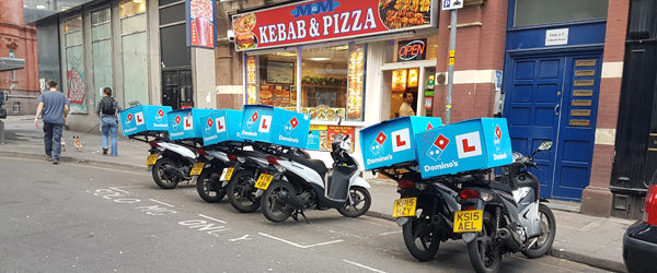
Hot food takeaways and delivery services can lead to the presence of many short-stay customers and delivery drivers. This can lead to 'fly-parking', which is short-term but indiscriminate parking behaviour that creates safety issues, such as visibility obstruction or blocking the safe flow of traffic.
A lack of acceptable parking provision can also affect the surrounding area and local residents.
We will not support hot food takeaway and delivery proposals if there are highway safety concerns to the following highway features and circumstances (this list is not exhaustive):
- pedestrian crossings
- bus stops
- double yellow lines
- loading restrictions
- road junctions or sharp bends
- narrow or poorly aligned carriageways
- circumstances where drivers may be tempted to park on the footway
- areas with limited on-street parking space nearby
If you're unable to demonstrate that parking or stopping will be safe, we'll recommend refusal of your planning application.
Supporting documents
pdf Street Design Matrix(671 KB)
3.1.1 pdf Off-street parking spaces and private drives(210 KB)
3.1.2 pdf Grade separated streets(150 KB)
3.1.3 pdf Shared surface streets(132 KB)
3.1.4 pdf Industrial roads(96 KB)
3.2.1 pdf Junction spacing and treatment(186 KB)
3.2.2 pdf Visibility(227 KB)
3.2.3 pdf Deliveries and servicing(118 KB)
3.2.4 pdf Emergency access(91 KB)
3.2.5 pdf Turning and swept paths(142 KB)
3.2.6 pdf Traffic calming(129 KB)
3.2.7 pdf Gradients(139 KB)
3.3.1 pdf Designing for cycling(1017 KB)
3.3.2 pdf Designing for walking(877 KB)
3.3.3 pdf Crossing facilities(205 KB)
3.3.4 pdf Public Rights of Way(156 KB)
3.4.1 pdf Designing for buses(164 KB)
3.4.2 pdf Making changes to bus routes and bus stops(117 KB)
3.5.1 pdf Cycle parking(499 KB)
3.5.2 pdf Cycle parking supporting facilities(70 KB)
3.5.3 pdf Car Parking(884 KB)
3.5.5 pdf Motorcycle parking(111 KB)
3.6.1 pdf Waste management(149 KB)
3.6.2 pdf Underground utilities(106 KB)
3.6.3 pdf Drainage(140 KB)
3.7 pdf Adoptable highway material palette(197 KB)
3.8.1 pdf Highway features general principles(100 KB)
3.8.2 pdf Street lighting(146 KB)
3.8.3 pdf Bollards(121 KB)
3.8.5 pdf Advertisements(201 KB)
3.8.6 pdf Telecommunications equipment(69 KB)
3.8.7 pdf ATMs (cash points)(80 KB)
3.8.8 pdf Street bins(83 KB)
3.9 pdf School developments(143 KB)
3.10 pdf Green infrastructure, trees and soft landscaping(838 KB)